Geolocation. Display location of the user on the map
The service can display the user's current location on the map. Rather, the location of the device from which the user accesses the service.
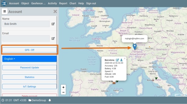
Geolocation is determined using HTML5-enabled browser tools. When turned on, the user's current position is displayed with a marker with a non-closing tooltip. The tooltip displays the user login. When turned on, after receiving the current coordinates, a marker is added to the map, and the map is centered on this marker. Subsequently, when changing the coordinates, centering for the user's marker is not performed. For mobile applications, the location is determined quite accurately, for desktop computers and tablets that are in closed rooms, the error in determining the location can be significant.
To enable geolocation, open the user settings panel (click on the “Account” element in the main menu). The geolocation button is located immediately before the button for selecting the language of the application interface. At the first click on this button, the browser will ask for system permissions to get the coordinates. Permissions apply to all users who access the service through this browser or mobile application. That is, a repeated permission request for this or another user is not executed.
For the mobile application Vialatm2 (Android), after giving permission to determine the geolocation, you need to click the button again. After clicking, the text on the button changes to “GPS – Off”. The location marker is not displayed immediately, but after receiving the first coordinates. When turned off, the location marker is removed from the map, and the text on the button changes to “GPS - On”.